
Mount Kilimanjaro Rongai Route – 6, 7 or 8 DaysNorthern Approach
Mountain Trek (Camping Route + Huts near summit)
Simba • Second Cave • Kikelewa • Mawenzi Tarn • Kibo • Horombo • Uhuru Peak
Description
Climb Kilimanjaro via the remote northern Rongai Route. This scenic, less-crowded approach begins near the Kenya border and traverses beautiful moorlands beneath Mawenzi before joining the summit route at Kibo. Camping is used on most nights; Kibo and Horombo huts are used near the summit and on descent.
Choose 6, 7 or 8 days: 6 days is the classic ascent; 7–8 days add acclimatization time at Mawenzi Tarn or Second Cave for improved success and comfort. Fully supported with experienced mountain guides, porters, meals, park fees and transfers.
Trek Highlights
Camping route with Kibo & Horombo huts near summit
Remote northern approach with fewer crowds and great views
Optional acclimatization day at Mawenzi Tarn (7–8 day plans)
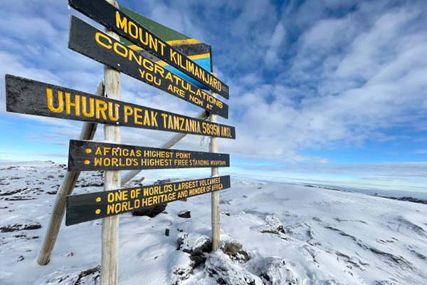
Summit attempt from Kibo to Uhuru Peak (5,895m)
Experienced mountain guides, porters and meals included
Day-by-Day Rongai Route Itinerary
Day 1: Rongai (Nalemoru) Gate → Simba Camp
3–4 hours • 6–8 km • 2,000 m → 2,600 m
The Rongai Route is Kilimanjaro’s only route approaching from the northern, Kenyan side of the mountain, offering a completely different perspective on the peak — drier conditions, less foot traffic, and a wilderness experience markedly different from the southern routes. The journey begins with a two-to-three-hour transfer from Moshi or Arusha to the Nalemoru Gate near the Kenyan border, where park registration and team introductions are completed. The trail enters a dry montane forest characterised by Podocarpus trees, wild date palms, and heathers, with direct views of Kibo’s northern face — a perspective that reveals the mountain’s geology more clearly than any other route. The northern slopes are noticeably less humid and denser in wildlife; eland, elephant, and buffalo tracks are commonly found on the trail. The ascent to Simba Camp (2,600 m) is steady and manageable, taking three to four hours with time for regular stops at viewpoints. Simba Camp sits in open heathland with sweeping views down to the Kenyan plains, and on a clear evening the savannah glows gold in the sunset far below. Your porter team has camp fully set up and dinner ready on arrival.
Accommodation: Simba Camp (2,600 m) | Meals: Breakfast, Lunch & Dinner
Day 2: Simba Camp → Second Cave Camp
3–4 hours • 7 km • 2,600 m → 3,450 m
The second stage continues the steady climb through the heather-moorland zone, following a broad ridge with widening views of the northern plains and the sharp, dramatic profile of Mawenzi to the southeast. The landscape opens progressively as the trail gains altitude, transitioning from heather-shrouded hillsides to open moorland with scattered giant lobelias and everlasting flowers. The northern face of Kibo is now more fully revealed — a clean, steep cone of volcanic rock and ice without the dramatic glacial ravines visible from the south. Second Cave Camp (3,450 m) is named for a shallow lava tube cave that provided shelter for early climbers before proper camping infrastructure existed. The campsite sits in open moorland with excellent views of both Kibo and the full Mawenzi massif, which from this angle displays its most impressive volcanic architecture. The cool, dry air of the northern slopes makes camping comfortable; your porters will have hot tea and warm washing water ready when you arrive, and the camp cook prepares a substantial dinner as the temperature drops after dark.
Accommodation: Second Cave Camp (3,450 m) | Meals: Breakfast, Lunch & Dinner
Day 3: Second Cave Camp → Kikelewa Camp
3–4 hours • 6 km • 3,450 m → 3,600 m
Today is a shorter, gentler stage designed to allow steady acclimatization as the route traverses the northeastern slopes toward the Mawenzi massif. The trail continues through open moorland, passing through zones of increasingly sparse vegetation as altitude replaces heather-dominated scrub with bare tussock grass and cushion plants. Giant groundsels appear in increasing numbers, reaching heights of two to three metres and giving the landscape a Jurassic quality that is distinctive and memorable. Mawenzi’s dramatic jagged ridgeline dominates the view to the south, while the trail approaches closer to its base with every hour of walking. Kikelewa Camp (3,600 m) sits in a sheltered hollow on the northeastern slopes, surrounded by enormous groundsels and protected from the prevailing northerly winds. The camp is rarely crowded — the Rongai Route sees significantly fewer trekkers than the Machame or Lemosho routes — giving the site a genuine wilderness atmosphere. Your guide uses the afternoon rest period to reinforce acclimatization advice and prepare you mentally and physically for the increasingly demanding stages ahead.
Accommodation: Kikelewa Camp (3,600 m) | Meals: Breakfast, Lunch & Dinner
Day 4: Kikelewa Camp → Mawenzi Tarn Camp
3–4 hours • 5 km • 3,600 m → 4,330 m
One of the most dramatic days on the Rongai Route, today’s ascent carries you into the high-altitude moorland beneath Mawenzi’s towering volcanic spires to the extraordinary Mawenzi Tarn — a glacial lake cradled in a rocky cirque at 4,330 metres. The trail climbs steeply through a zone of dense groundsels and lobelias before breaking out onto the bare, rocky slopes below Mawenzi’s shattered summit ridges. The scale of the geological forces that shaped Mawenzi becomes viscerally clear at this altitude — the peak is the remains of a collapsed volcanic vent, its original structure destroyed in a catastrophic explosion that left the jagged, multi-spired form visible today. Mawenzi Tarn Camp is set beside the lake in one of the most visually arresting camp locations on the mountain: black volcanic cliffs rise on three sides, the still lake reflects the sky, and on clear evenings Kibo’s snow-capped summit is visible to the west. The altitude here requires conscious, deliberate hydration and a slow, calm afternoon of rest and preparation for tomorrow’s long crossing of the Saddle to Kibo Hut.
Accommodation: Mawenzi Tarn Camp (4,330 m) | Meals: Breakfast, Lunch & Dinner
Day 5: Mawenzi Tarn Camp → Kibo Hut
4–5 hours • 10 km • 4,330 m → 4,700 m
Leaving Mawenzi Tarn, the trail crosses the broad “Saddle” that stretches between Mawenzi and Kibo — a desolate, wind-scoured alpine desert of volcanic scree, pumice, and fractured lava with no vegetation and virtually no shelter. The crossing of the Saddle is one of the most visually dramatic stages on Kilimanjaro: Mawenzi’s dark, fractured spires recede behind you as Kibo’s massive, smooth cone grows larger with every step. The terrain is flat and the gradient gentle, but at 4,300–4,700 metres the altitude makes every kilometre feel hard-earned. The cold and the wind are constant companions on the Saddle crossing, and proper layering is essential even on the clearest days. Kibo Hut (4,700 m), the stone dormitory at the base of Kibo’s crater wall, is visible for the last hour of the walk, growing slowly closer across the open desert. Arrive early afternoon for maximum rest; your guide serves dinner at 5:00 pm, briefs the group on the midnight summit procedure, and ensures everyone is in their sleeping bags by 7:00 pm.
Accommodation: Kibo Hut (4,700 m) | Meals: Breakfast, Lunch & Dinner
Day 6: Summit Night — Uhuru Peak (5,895 m) → Descent to Horombo
10–14 hours • 4,700 m → 5,895 m → 3,720 m • The hardest day
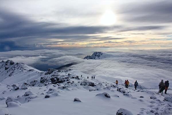
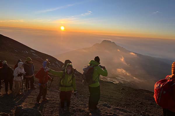
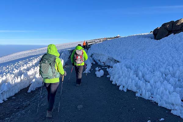
The alarm sounds at midnight or 1:00 am, and within thirty minutes your group is dressed, equipped, and moving upward into the darkness. The ascent from Kibo Hut follows the same crater wall route used by the Marangu Route, switchbacking up steep, loose scree in the cold and dark with headlamps as the only light. The Rongai approach to summit day benefits from the extra acclimatization of the northern traverse, and many trekkers find the midnight push slightly more manageable after four nights of gradual altitude gain. Hans Meyer Cave at ~5,100 m is a common rest point; from here the gradient steepens toward William’s Point and the final approach to Gillman’s Point (5,681 m) at crater rim. From Gillman’s, the full panorama of Kilimanjaro’s crater — the ash pit, the inner cone, and the retreating glaciers — is revealed at first light. The traverse of the crater rim to Stella Point (5,739 m) and then to Uhuru Peak (5,895 m) takes 45 minutes to an hour and is completed in full daylight with views that encompass all of East Africa. The descent after summit follows the Kibo Hut route back down to the Saddle and continues all the way to Horombo Hut (3,720 m) for overnight.
Accommodation: Horombo Hut (3,720 m) | Meals: Breakfast, Lunch & Dinner
Day 7: Horombo Hut → Marangu Gate → Transfer
5–6 hours • 18 km • 3,720 m → 1,860 m
The final descent on the Rongai Route follows the Marangu Route path from Horombo back through the moorland, through Mandara Hut, and down through the rainforest to the Marangu Gate. Despite tired legs and the cumulative physical effort of six demanding days, the 18-kilometre descent through Kilimanjaro’s ecological zones is a deeply satisfying conclusion to the climb. The forest section in particular — warm, green, and rich with wildlife after the barren upper mountain — feels like a triumphant return to the living world. At the Marangu Gate, the KINAPA sign-out and certificate ceremony issues the official record of your achievement: a gold certificate for Uhuru Peak, a green certificate for those who reached Gillman’s or Stella Point. The farewell with your guide and porter team — who have carried, cooked, guided, and motivated you for seven days — is a genuinely moving occasion filled with song, shared pride, and the distribution of well-deserved tips. Transfer to Moshi or Arusha, where the comforts of civilisation have never been more welcome.
Accommodation: N/A — Return to Moshi / Arusha | Meals: Breakfast & Lunch
Includes & Excludes
Kilimanjaro park fees, camping & applicable hut fees
Certified mountain guide, porters and cook
All meals on the mountain (breakfast, lunch, dinner)
Drinking water during the trek
Transfers: Moshi/Arusha ↆMarangu Gate
Rescue fees and government taxes
International flights and Tanzania visa
Travel & medical insurance (mandatory)
Personal trekking gear (boots, clothing, sleeping bag)
Hotels before/after trek and meals in town
Tips for crew (guide, porters, cook)
Optional personal snacks and alcoholic beverages
Frequently Asked Questions
The best seasons are June–October and January–March for stable weather. Rongai's northern aspect can be drier than southern routes, making it a good choice in shoulder seasons. Expect cold nights near Kibo and possible rains in April–May and November.
Rongai is primarily a camping route (Simba, Second Cave, Kikelewa, Mawenzi Tarn). Near the summit and descent, Kibo and Horombo hut areas are used. We provide four-season tents, mattresses and hot meals; bring a warm sleeping bag and personal toiletries.
Rongai is considered moderate with steady gradients and excellent acclimatization on 7–8 day plans. The summit day is long. Suitable for fit first-timers; regular training (hikes, cardio) and proper gear are essential.
Essential items: sturdy trekking boots, layered clothing, waterproof jacket/pants, warm hat and gloves, headlamp with spare batteries, trekking poles, SPF sunscreen, 3L hydration system, personal meds, and a 4-season sleeping bag. A detailed packing list will be provided.
We generally recommend Kilimanjaro treks for ages 12+ with good fitness. Altitude affects everyone differently; minors must trek with a responsible adult and follow guide advice. Contact us to assess suitability for your family and choose the right plan.
Kilimanjaro Trek Details
Route
Rongai Route (Northern Approach)
Duration
6, 7 or 8 Days
Camps & Huts
Simba • Second Cave • Kikelewa • Mawenzi Tarn • Kibo • Horombo
Max Altitude
Uhuru Peak (5,895 m)
Accommodation
Mountain tents; Kibo/Horombo huts near summit
Start & Exit
Start: Rongai (Nalemoru) Gate • Exit: Marangu Gate
Best For
Trekkers seeking a quieter, scenic northern approach
Trek Price
$Upon Request / Per Person
Price depends on route choice, group size & season
Why Book With Us
Expertise and Experience
Tailored Services
Comprehensive Planning
Client Satisfaction
24/7 Support
Contact Details
Mr. Yamat
Tour Operator
Call Us : +255 686 241 980
Email : info@safarismate.com
Related Kilimanjaro Routes
Price Upon Request
Price Upon Request
Price Upon Request
Price Upon Request